| Miner's Call to Sturgis
Fork of Carberry Creek, Josephine County, Oregon
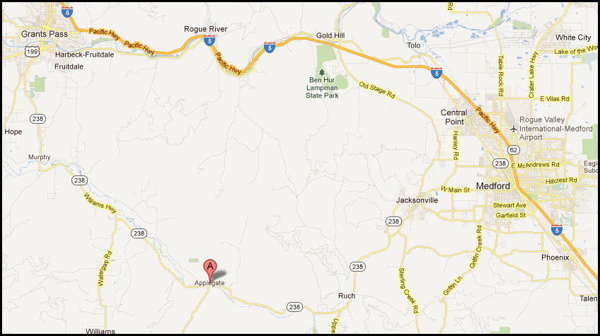
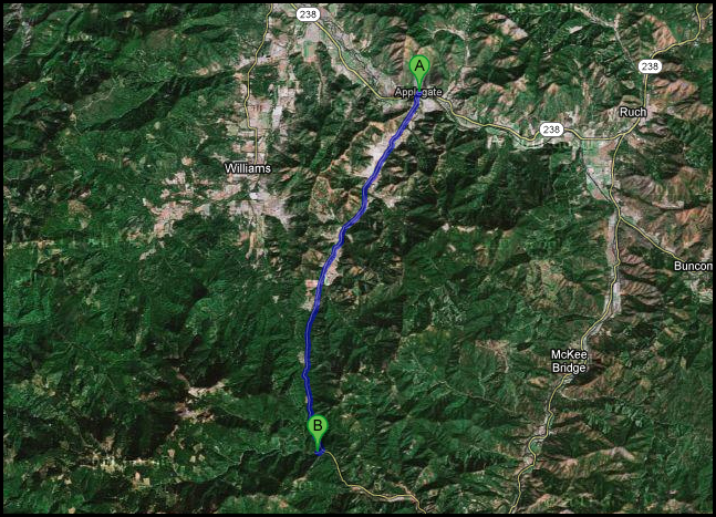
The Jefferson Mining District is requesting that miners and non-miners attend a peaceful protest at Dave Everist's "Twin Cedars" placer on the morning of Sunday, February 19th, 2012. Miner Everist has been involved in a long standing feud with the United States Forest Service. On February 9th, he was issued a letter by agents of District Ranger Donna Mickley to vacate by February 19th. USFS LEI agent Donald J. Ross told Everist and his associate Marcus Davis that if they did not vacate "Twin Cedars", that on Feb. 19th, he would arrest Everist and seize his personal possessions which would be destroyed or sold at auction. Miner Everist states that the illegal action of USFS is retaliation for the legal actions that he has been taking against USFS. He also states that he will not be forced to abandon his mining property by use of threats and that he will have to be lawfully removed from "Twin Cedars" by means of arrest. For more details on Miner Everist's situation, see: USFS Terror: Two Oregon Miners Expose Repressive & Illegal Agency Activity Miner Everist is requesting that all those interested come to Twin Cedars on Feb. 19th to be witnesses to his stand to defend his property which was granted to him by an Act of Congress and which is protected under Oregon State Law. He has specifically requested that the protest remain peaceful and that they bring their video cameras to document what takes place. He has specifically requested that those visiting leave their firearms and their tempers at home. We are expecting miners from as far away as the Shasta Valley and Willamette Valley to attend Twin Cedars is located a half mile from the old mining camp of Steam Boat and is situated at an elevation of 2700 feet. Dress warmly! We will have warming fires, hot coffee and a hot snack to help keep the chill off. Jefferson Mining District is also requesting that the agents of the Siskiyou Mountain Ranger District who have issued their threats show some back-bone and come to Twin Cedars on the 19th just as they have threatened to do. Please come and act openly opposed to coming under the cover of darkness like cowards and thugs. Provided that you act within the law, you have nothing to fear. Getting There - The Sturgis Fork of Carberry Creek is located a half mile upstream of the famous mining camp of Steam Boat (now marked only by a cemetery). Sturgis is approximately 13 miles south west of the small community of Applegate, Oregon which is located on Highway 238 almost exactly midway between Grants Pass and Medford. Applegate is accessed from the west from Grants Pass via Highway 238 through Murphy (19.3 total distance) and from the east from Medford through Jacksonville (20.5 miles)
For those who are familiar with the Carberry Creek area and would like to proceed to Twin Cedars -
For those who are NOT familiar with the Carberry Creek Area: Gather at Applegate Store in Applegate, Jackson County. Sunday 9 AM. We will have at least one miner dressed in bright yellow at Applegate to lead others into Sturgis. Approx. 9:30 AM, whomever is gathered at Applegate will be led up Thompson Creek Rd to the Sturgis Fork of Carberry Creek (1/2 mile from the old mining camp of SteamBoat). We will leave a miner at Applegate for awhile in case there are any stragglers. If Sturgis is snowed over,
we will arrange for a crew cab 4WD to transport people in.
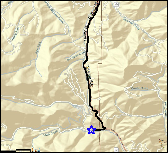
PLSS info for Twin Cedars, Sturgis Fork of Carberry Creek: Township 40 South, Range 5 West, Section 13, NE 1/4 GPS info for Twin Cedars: Lat/Long: 42.091437 , -123.231613
|
Mining
Rights (dot) org is copyright 2010 by the South West Oregon Mining
Association